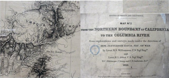
Lieutenant Williamson's Map of 1855
This map was drawn by Lieutenant R.S. Williamson and published in 1855. Lt Williamson explored from the Applegate trail to the Pacific Coast in the early 1850s and one of the maps shows those trails with his name and the year he made the exploration. Cow and Wolf Creek have been named. And there is a road house near Wolf Creek named "Six Bit House".