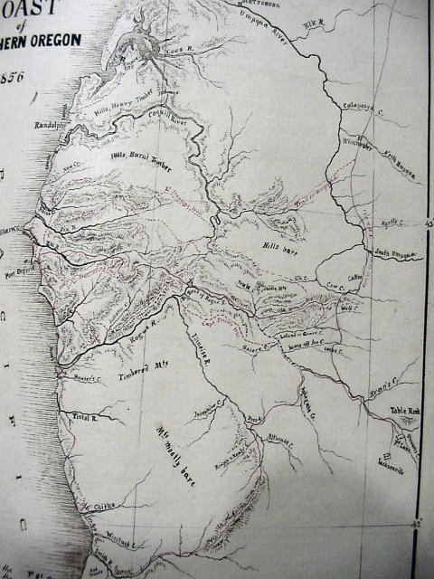
Lt Kautz Map of Oct 1855
This map of October 1855 has many of the larger creeks and rivers named around the area that would eventually be Glendale. The trails are marked in red with names next to those that were thought to be the first to blaze or explore them. Note the places where mountains are listed as "bare". This must have been caused by either large forest fires in the past or the mountains were so large that they were above the timberline. The only places where people were shown was at Jacksonville and Fort Lane to the south and then Winchester on the Umpqua to the north.